

Austin weather: Enhanced risk of severe storms with heat indices near 100

Austin weather: Severe storms enhanced risk
We will replace the heat alerts with a LEVEL 3 Severe Weather Day. Most of the rain and storms will happen late afternoon and tonight. Zack Shields has all the details in his full forecast.
AUSTIN, Texas - The steamy heat won't be as intense, and we will trade in the heat alerts for an enhanced risk of severe storms.
Highs heading for the mid 90s and heat indices near 100.
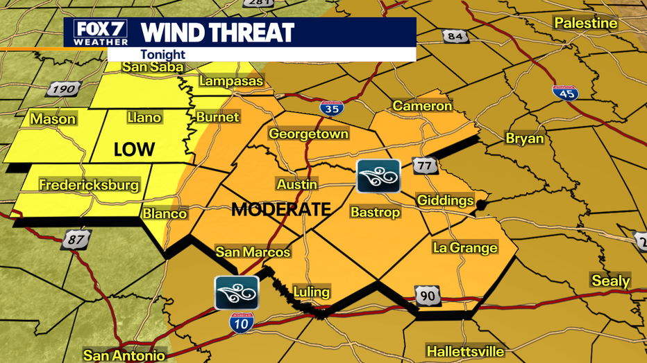
Then tonight we will be under a LEVEL 3 severe weather risk with damaging winds being the main threat. Buckle up, we are about to go into a very active weather pattern with increasing rain chances.
Two rounds of storms are possible. The first round is expected around 2-5 p.m. and is expected to be isolated.
The second round, which is expected to be more numerous, should be around 8 p.m to 3 a.m.
The highest risk for those damaging winds is from Austin to La Grange and the gusts could be 50 to 80 mph.
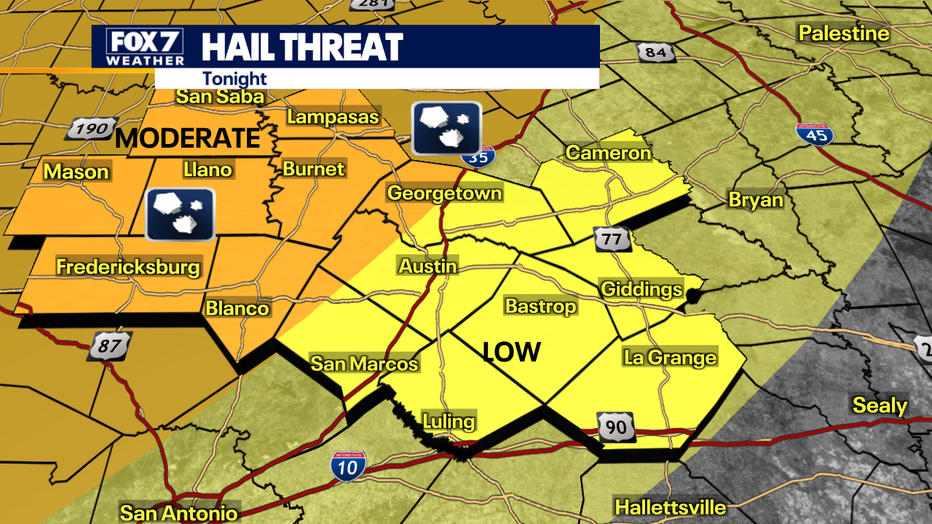
Hill Country has the highest risk for hail with sizes anywhere from quarter to egg sized.
Rain totals could be 1" to 3" depending on the area.
There is a low tornado risk and minor flooding at low-water crossings is possible.
Track your local forecast for the Austin area quickly with the free FOX 7 WAPP. The design gives you radar, hourly, and 7-day weather information just by scrolling. Our weather alerts will warn you early and help you stay safe during storms.