

Austin weather: Flash Flood Watch in effect for most of the week
Austin weather: Flash flood watch in effect
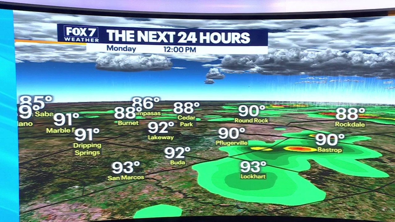
It's not your typical Summer time setup for the week ahead. We have a Flash Flood Watch for half of Central Texas until Thursday night. Zack Shields has more in his full forecast.
AUSTIN, Texas - It's not your typical summertime setup for the week ahead.
Flash Flood Watch in effect
Big picture view:
Half of Central Texas is under a Flash Flood Watch until 7 p.m. Thursday
A series of upper lows will glide over the tropical moisture and provide enough lift to produce rounds of heavy rain this week.
RELATED: What is the difference between a flood watch, advisory and warning?
Timeline:
The first round will arrive today (July 13) between 3 p.m. and 9 p.m.
The storms will come in from the north and first impact the Hill Country this afternoon, before entering the I-35 corridor around the afternoon drive.
This is just the opening act because the main heavy rain event will occur Tuesday and Wednesday.
For Monday and Tuesday, we are under a LEVEL 2 out of 4 for localized flooding with the higher risk showing up near Del Rio, and a moderate to high risk of street flooding and ponding on the roads.
We still have flash flooding and river flooding risk at low to moderate for now.
This is not the same setup we had last July because we don't have the remnants of a tropical system nearby but stay weather aware.
By the numbers:
The computer weather models and the National Weather Service indicate 1 to 3 inches of rain likely over the next three days.
Some areas could get a little more, leading to some localized flooding.
What you can do:
Track your local forecast for the Austin area quickly with the free FOX 7 WAPP.
The design gives you radar, hourly, and 7-day weather information just by scrolling.
Our weather alerts will warn you early and help you stay safe.
You can also keep an eye on low water crossings and road closures at atxfloods and DriveTexas.org.
The Source: Information in this report comes from Zack Shields