

Austin weather: 2 cold fronts set to arrive this weekend

Austin weather: When will Arctic chill arrive?
Temperatures will be the warmest they'll be for some time once the cold fronts arrive. When will that happen? Zack Shields has all the details in his full forecast.
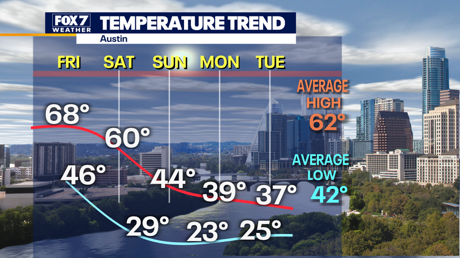
AUSTIN, Texas - Enjoy the warm temperatures today as it will be the warmest day in the next two weeks.
Weather in Austin today
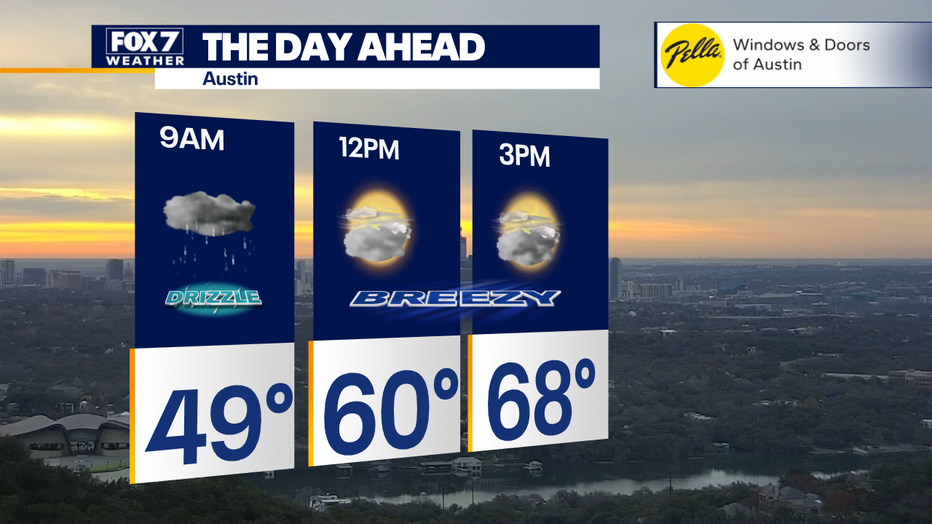
The clouds are back along with a few sprinkles this morning.
Thanks to a stronger southerly breeze the clouds will not slow down the warm up.
Highs heading for the upper 60s and low 70s.
When does the cold front arrive in Austin?
What we know:
The Polar Vortex is heading for the Midwest, and it will send us two cold fronts.
One front will arrive early on Saturday and the second one is set to arrive on Sunday morning.
The weather will turn sunny, windy and colder this weekend with highs and lows running 20 to 30 degrees below average for several days and nights.
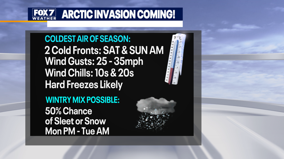
It's expected that there will be five freezing mornings in a row from Sunday to Thursday.
Winds are predicted to be 15-25 mph on Saturday and 25-35 mph on Sunday.
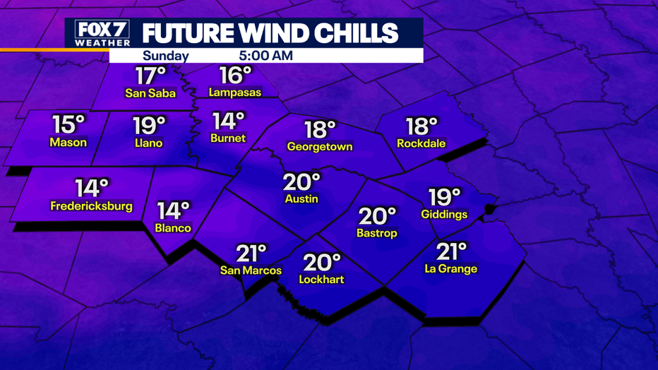
Wind chills will be in the teens and early 20s on Sunday.
Will it snow in Austin?
What we don't know:
A "mini" Western low will glide over the cold air next week to set the stage for possible wintry mix.
How much, and exactly where and what kind of precipitation, is still not exactly clear as projections could change.
It will depend on the timing of the upper low and how much moisture will be available.
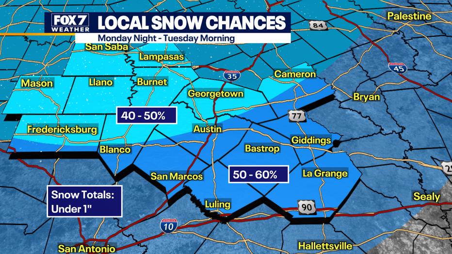
Snow chances are trending higher for Monday night into Tuesday morning.
Conditions should be cold enough for snow or sleet as it's predicted to happen during the coldest part of the day.
Accumulation is expected at under an inch.
What you can do:
Track your local forecast for the Austin area quickly with the free FOX 7 WAPP.
The design gives you radar, hourly, and 7-day weather information just by scrolling.
Our weather alerts will warn you early and help you stay safe during storms.
The Source: Information from meteorologist Zack Shields.