

Austin weather: A triple-digit temperature streak on the way

Austin weather: Record-breaking triple-digit heat
We're going to see temperatures go into the 100s this week. Zack Shields has all the details in his full forecast.
AUSTIN - The sunny weather we had over the weekend will continue as we start a new week, but it will be a lot warmer. The latest rain and cooling machine is spinning away from us and the heat dome will take its place all week.
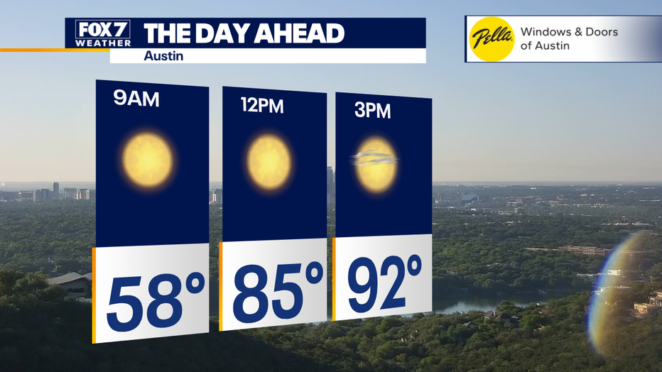
Monday Forecast
Sunny this morning, a few clouds this afternoon, but no signs of rain, not only around here but across the entire state.
Highs today are heading towards the low 90s, but the humidity will remain low tonight, with a clear sky.
Tuesday–Friday Forecast
Big picture view:
Get ready. Summer is coming in a big way!
It's going to be warmer than average from Texas all the way up in the Midwest. We're looking at highs running 10 to 20 degrees warmer than average.
There will be a triple-digit streak with daily record highs being broken, and we could experience our hottest May afternoon ever on Wednesday.
The temperatures Tuesday through Thursday will be 100 to 104 degrees; no easing into it.
Remember to listen to your body, take it easy, and stay hydrated.
The average high is 86. That's where we should be for this time of year. With the gulf breeze kicking in, it will bring in more moisture, which means more humidity. So the nights will start to warm up with lows in the 70s instead of 40s and 50s.
The air conditioners will be working overtime this week, and the rain gauges will stay empty. The next time we can put at least a slight chance of rain in the forecast will be early next week.
It will feel like August with daily record highs being shattered, and rain-free skies through the weekend.
The Source: Information in this article is from FOX 7 Austin Meteorologist Zack Shields.