

Low to slight risk for severe weather in Austin area late Sunday night

Carlo's Morning Weather Forecast (10/10)
Here's Carlo Falco's Morning weather forecast for October 10th.
AUSTIN, Texas - The National Weather Service is forecasting a slight risk for severe weather for northwest Williamson County, north Burnet County and northeast Llano County on Sunday.
There is also a very low risk for severe weather across the rest of the FOX 7 viewing area, including the Austin metro area and I-35, with a possible severe thunderstorm watch later Sunday afternoon.
Severe weather is expected to roll through tonight into Monday morning, starting about 9 p.m. in the Hill Country to through about 3 a.m. Monday in the Austin metro area.
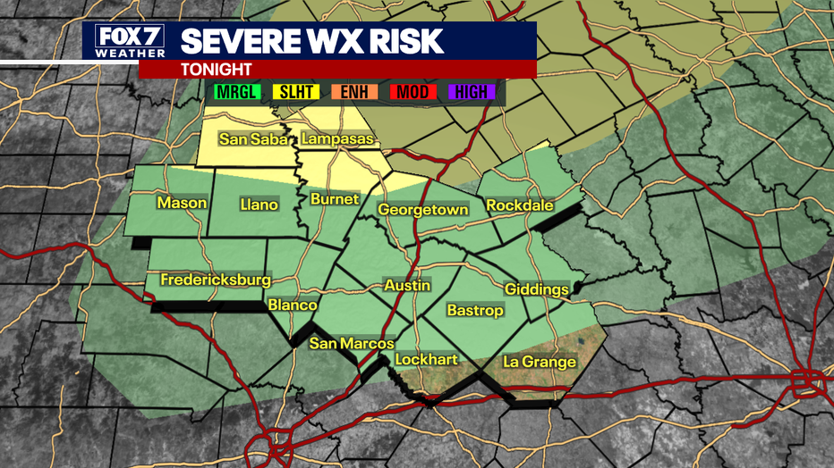
There is a isk of small hail up to the size of quarters and up to 60 mph wind gusts. There is a very low, but not zero tornado threat and an extremely low risk for flash flooding.
The final day of Austin City Limits Music Festival should not be affected by the severe weather. Up in Dallas, the State Fair of Texas has decided to close 30 minutes early due to the weather forecast.
A potent upper level low pressure system is expected to bring significant severe weather to east-central Oklahoma. The attached cold front will push through central Texas bringing strong and severe thunderstorms with mainly a wind and small hail threat.
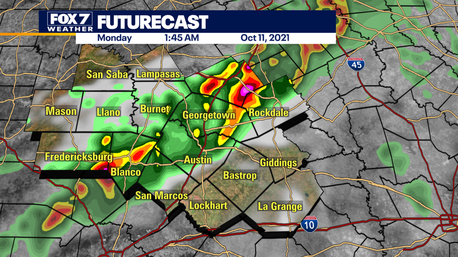
Central Texas is too far south for widespread significant severe weather, though the storms should bring lots of lightning, brief gusty winds and the possibility of some small hail. A spin-up tornado is possible though not likely.
Significant damaging severe weather is not expected though we will continue to monitor as the forecast is expected to change slightly

Track your local forecast for the Austin area quickly with the free FOX 7 WAPP. The design gives you radar, hourly, and 7-day weather information just by scrolling. Our weather alerts will warn you early and help you stay safe during storms.
___
DOWNLOAD: FOX 7 AUSTIN NEWS APP
SUBSCRIBE: FOX 7 Austin Daily Newsletter | FOX 7 Austin on YouTube
FOLLOW: Facebook | Instagram | Twitter