

Another round of severe weather possible in Central Texas tonight

AUSTIN, Texas - Central Texas could be in for more severe storms Wednesday night into Thursday morning as an upper-level disturbance sweeps through the state.
Wednesday evening, isolated severe storms will be possible.
The main hazards in these storms will be quarter-size hail or larger, damaging winds, and isolated tornadoes. As of 5 p.m. Wednesday afternoon, Lampasas, Burnet, Llano, Mason, and San Saba Counties were under a Tornado Watch that continues through 10 p.m.
Late tonight, more storms could move in from the southwest.
The threat for severe storms will again be highest in the Hill Country with the main hazards being large hail, gusty winds, and isolated tornadoes. Storms will move east towards the I-35 corridor between 2 a.m. and 4 a.m.
By sunrise, most of the stormy weather will be out of Central Texas.
DOWNLOAD THE FOX 7 AUSTIN NEWS APP
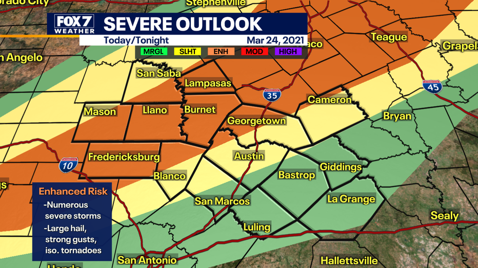
Updated severe outlook shows an Enhanced Risk for severe weather across most of the Hill Country. (Chelsea Andrews / FOX 7 Austin)
While the severe threat will likely decrease as storms move east after midnight, residents in Central Texas should be prepared to get to the safe space in their homes, if a Tornado Warning is issued. This would be in a sturdy shelter, in an interior, windowless room on the lowest level of the building.
Have a way to get weather alerts while you’re asleep. This can be Wireless Emergency Alerts on most smartphones, NOAA Weather Radios, or weather apps like the FOX 7 WAPP.

SIGN UP FOR FOX 7 AUSTIN EMAIL ALERTS
Track your local forecast for the Austin area quickly with the free FOX 7 WAPP. The design gives you radar, hourly, and 7-day weather information just by scrolling. Our weather alerts will warn you early and help you stay safe during storms.