

Austin area bracing for summer heat before weak boundary brings overnight rain chances
Austin weather: July 5 morning forecast
Austin and Central Texas wrap up the holiday weekend with stifling humidity and upper 90s heat before an overnight weather boundary introduces rain chances for Monday.
AUSTIN - Central Texans wrapping up the July Fourth holiday weekend should prepare for another sticky, sweltering day Sunday before a weak weather boundary brings a chance of overnight storms and afternoon rain to start the workweek.
Waking temperatures on Sunday started in the upper 70s under light morning cloud cover in downtown Austin, with outlying areas like Blanco and La Grange seeing temperatures in the low-to-mid 70s. Meteorologists warned that conditions would heat up rapidly under a steady south-southeast wind.
While official high temperatures are expected to max out in the upper 90s, just shy of the triple-digit mark, high dew points in the 70s will create a thick layer of humidity, pushing feel-like values well into the 100s.
Residents looking to spend the remainder of the holiday weekend outdoors or by the pool are urged to stay hydrated.
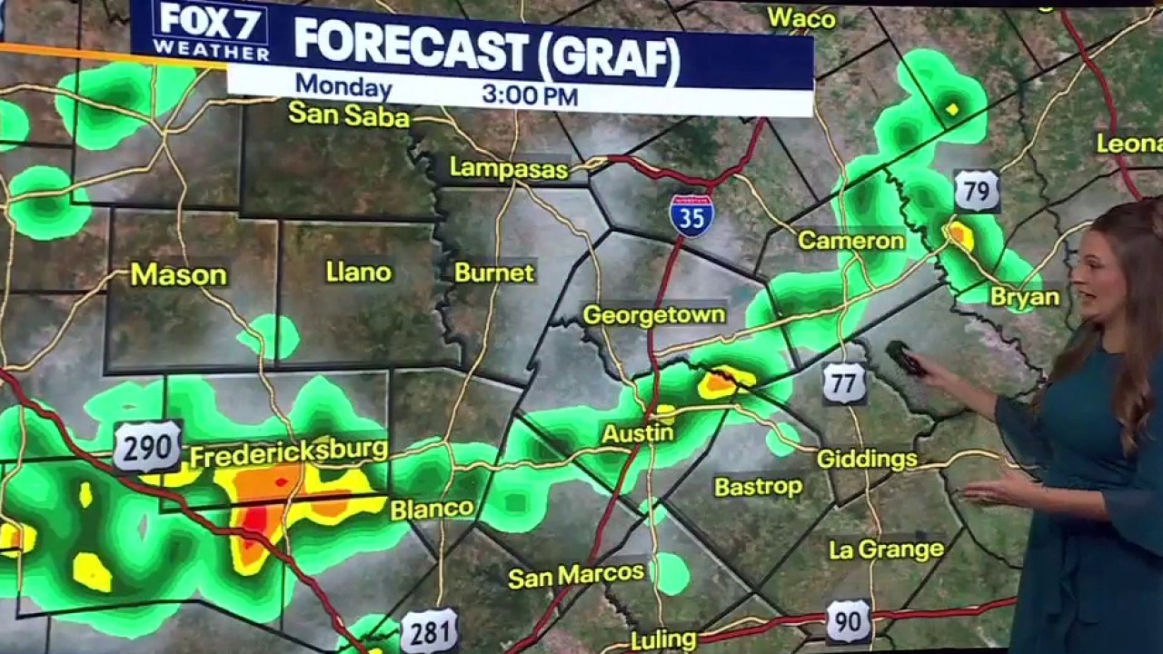
Monday: Shifting Boundary Brings Rain Chances
Relief from the dry spell could arrive late Sunday night as a weather boundary pushes south into Central Texas.
The Hill Country has the highest probability of seeing the initial wave of weather, which could bring heavy downpours at times between 11 p.m. Sunday and 1 a.m. Monday. While the system is expected to weaken as it moves south and east, it will set the stage for unsettled weather on Monday.
Monday afternoon is not projected to be a total washout, but scattered showers and storms are expected to bubble up during the peak hours of daytime heating. Rainfall totals through early week are estimated to average around a quarter of an inch, with isolated areas picking up closer to half an inch.
Rest of the Week: Heat and Humidity Persist
The unsettled pattern will linger into Tuesday, keeping isolated storm chances in the forecast for the afternoon.
By midweek, the chances of rain diminish, and Central Texas will settle back into a classic, hot summer pattern. An extended 8-to-14-day outlook indicates that warmer-than-average temperatures are here to stay.
While official triple digits have been left off the immediate seven-day forecast, afternoon highs from Wednesday onward will consistently flirt with the 100-degree mark amid unrelenting humidity.
The Source: Information in this article is from the FOX 7 Austin weather team.