

Austin weather: Flood Watch issued as heavy rain, strong storms
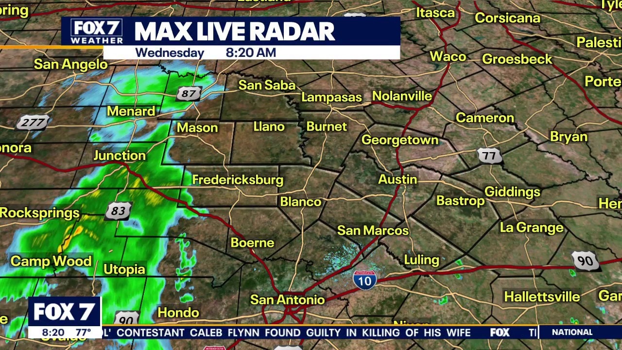
Austin weather: When is the rain coming?
Zack Shields has all the details in his full forecast and talks about possible flooding and cooler temperatures.
AUSTIN, Texas - Wrapping up September but the changing weather is just beginning.
The backstory:
The table is set for multiple rounds of downpours and storms the next few days.
The tropical moisture is in place and a low pressure system and front will collide into the moisture to help turn on the rain.
The slow-moving front will be the focal point for storm development and the lift from upper will keep the storms going strong.
Why you should care:
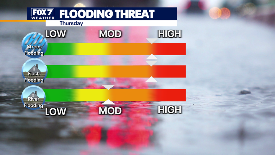
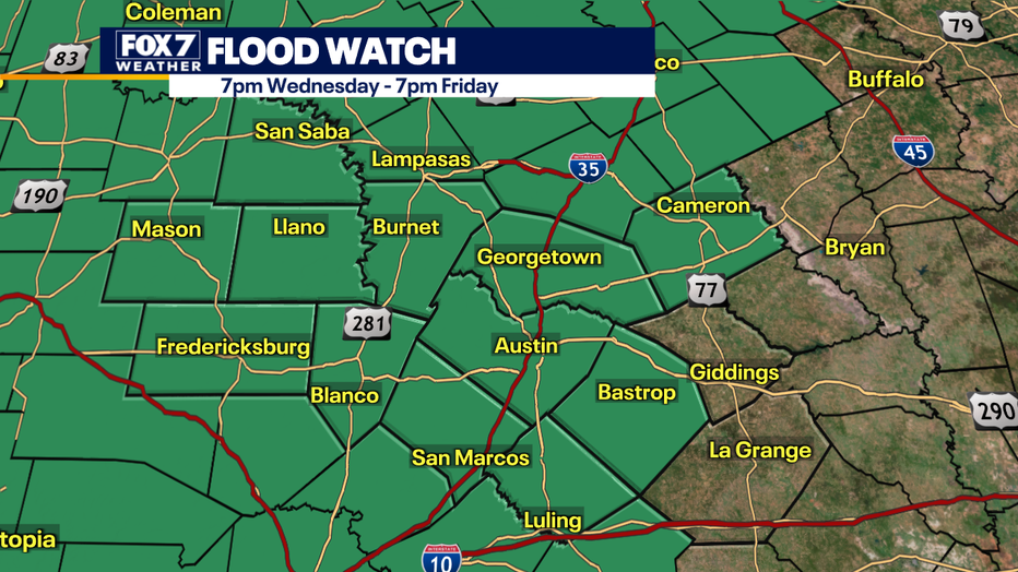
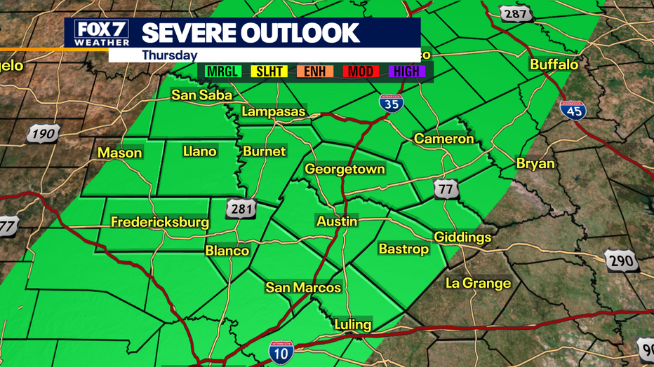
Most of Central Texas is under a FLOOD WATCH from this evening to Friday evening.
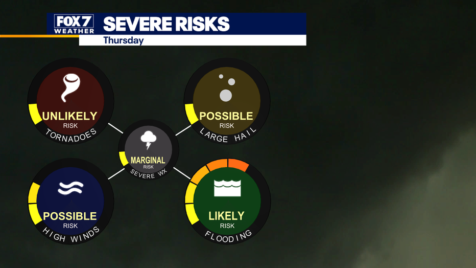
There is a moderate to high risk of street, flash and river flooding especially on Thursday.
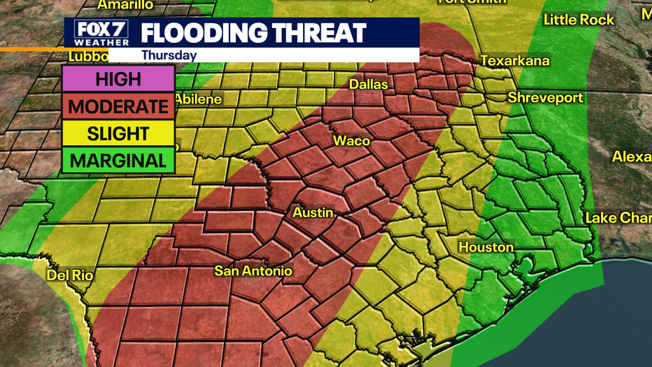
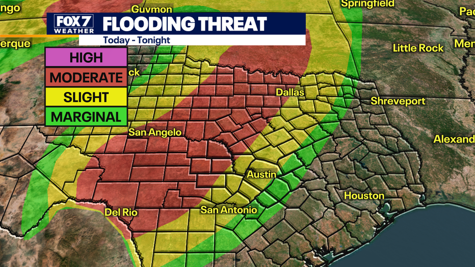
The flooding risk stays to our west today and tonight but then we are in the middle of the LEVEL 3 (moderate) risk of flooding Thursday.
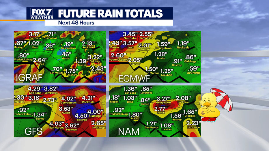
On average 2-4" of rain is possible but isolated areas will get 4-6".
Where the highest totals will occur will be the biggest forecast challenge.
When will the storms arrive in Central Texas?
Timeline:
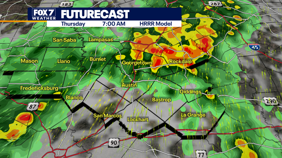
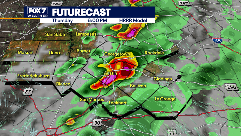
We will get two rounds tomorrow.
The first round early in the day with scattered storms, moderate rain and lightning.
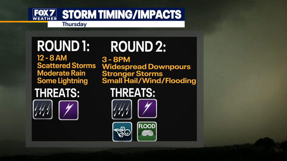
The second round will happen late on Thursday with widespread heavy rain, strong storms, flooding risk, small hail and gusty winds.
The flooding risk will be main concern but we will be under a marginal risk of small hail and brief strong winds.
What you can do:
Buckle up and get ready for some wild weather.
Stay weather aware and track your local forecast for the Austin area quickly with the free FOX 7 WAPP.
The design gives you radar, hourly, and 7-day weather information just by scrolling.
Our weather alerts will warn you early and help you stay safe during storms.
The Source: Information from meteorologist Zack Shields.