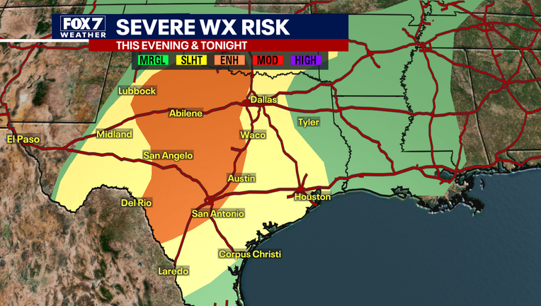
Enhanced risk for severe weather for Central Texas
AUSTIN, Texas - Please stay weather aware this evening and tonight and keep checking the latest forecast. We’ll update as necessary.
WHERE
The SPC is forecasting an ENHANCED RISK for severe weather for much of Central Texas, including the Austin Metro and Hill Country. A severe thunderstorm watch has been issued for most of West Texas and includes LLano, Mason, and Gillespie counties. That watch will likely be extended to include the rest of the area as the storms approach those western counties.
WHEN
Storms have formed in far West Texas and will start moving east later this afternoon and into the evening.
Hill Country timeline: 9-11 pm
Austin timeline: 11pm - 1 am.
HOW BAD (RISKS)
Up to 70 mph straight-line winds will be the main threat with these storms though quarter size hail is possible as well. The tornado threat is very low.
STORM TRACKER ACTIVATION
Activation is not likely today/tonight. Storms will make it to our western counties around/just after sunset and the Austin Metro after dark. The storms will be in a weakened state as they approach.