

Austin weather: Sunday rain and flood risk
Austin weather: Nov. 8 morning forecast
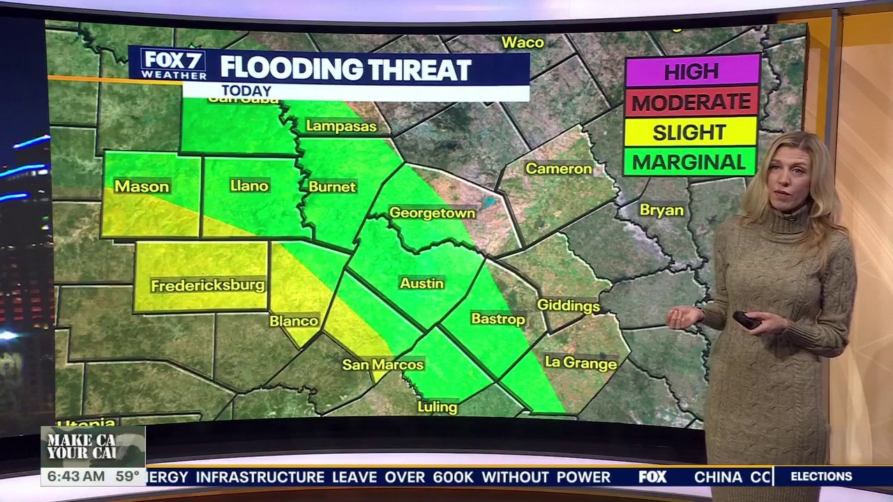
Steady rain will bring 1 to 3 inches southwest of Austin and minor street flooding risks to San Antonio and the Hill Country Sunday, with cooler highs in the 60s.
AUSTIN - Continuous rainfall, cool temperatures, and the potential for localized flash flooding marked the start of the weekend across Central Texas, with heavier storms striking areas further south.
Continuous rainfall
A broad weather system is bringing widespread showers and occasional thunderstorms to the Austin area. While the heaviest precipitation and active flash flood warnings remain concentrated in southern Texas, rain continues to track across the entire Central Texas viewing area.
Rainfall began moving into the Hill Country on Saturday afternoon before becoming more widespread overnight. Mason and Gillespie counties, along with areas around Fredericksburg, experienced some of the heaviest early rain, with parts of San Saba County recording more than an inch of precipitation over 24 hours.
Although rainfall is expected to taper off gradually Sunday evening, residents should carry rain gear and stay alert for potential weather warnings, particularly in low-lying or flood-prone locations west and south of Austin.
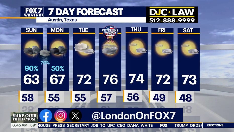
Cloud cover and persistent moisture will keep Sunday's temperatures unseasonably cool. Daytime highs are projected to reach around 62 degrees, only a slight increase from morning temperatures in the upper 50s, which included 59 degrees in Bastrop and San Marcos and 58 degrees in Rockdale and Williamson County. Dew points are expected to remain in the upper 50s, keeping humidity levels comfortable.
Monday weather
Unsettled weather will linger into Monday with additional light, scattered showers anticipated, though totals are expected to remain manageable around 1 inch.
Conditions will clear significantly as the workweek progresses. Rain chances decrease sharply after Monday, allowing sunshine to return alongside warmer afternoon temperatures in the 70s through the remainder of the week.
7-Day Forecast
The Source: Information in this article is from the FOX 7 Austin weather team.