

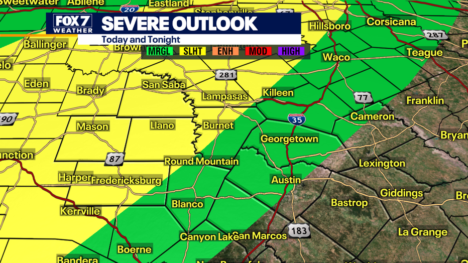
Stay weather aware: Slight risk of severe storms in Hill Country
AUSTIN, Texas - A late-season cold front will collide with the warm temperatures and humidity and could set off isolated to spotty severe storms west of Austin.
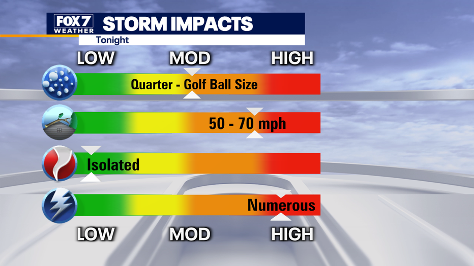
Severe storms have started to fire up in the Hill Country. These storms have a history of producing baseball size hail just to the west of the FOX 7 Austin viewing area in McCulloch County and golf ball size in our viewing area in Mason County.
Large hail and damaging winds will be the primary hazards with these supercells through sunset. After that, storms will gradually weaken.
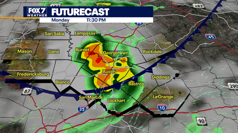
The storms won't get going until this evening.
DOWNLOAD THE FOX 7 AUSTIN NEWS WAPP
Good Day Austin meteorologist Zack Shields says we will get two rounds of storms. The first will occur early to mid-evening and the second one mid to late evening.
The computer weather models show the storms weakening and dropping below severe limits before reaching the Austin Metro.
SIGN UP FOR FOX 7 AUSTIN EMAIL ALERTS
FOX 7 Austin meteorologist Chelsea Andrews says that we can't completely rule out some rumbles of thunder, smaller hail around the I-35 corridor but the bigger stuff should stay west.
Stay weather aware and download the FOX 7 Austin WAPP!