

Austin weather: Flash Flood Warnings in effect

AUSTIN, Texas - A Flash Flood Warning is in effect for two Central Texas counties.
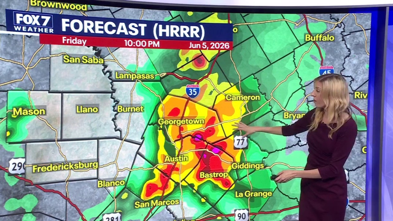
The warning covers northeastern Burnet County and western Williamson County until 10 p.m. tonight (June 5).
What they're saying:
The National Weather Service says that at 5:40 p.m., Doppler radar indicated thunderstorms and heavy rain across the area with between two and four inches having already fallen.
Additional rainfall amounts of one to three inches are possible.
Life-threatening flash flooding of creeks, streams, urban areas, highways, streets and underpasses is ongoing or expected to happen.
The NWS says some locations that could see flash flooding include: Cedar Park, Georgetown, Leander, Liberty Hill, Florence, Andice, Sun City and Seward Junction.
What you can do:
The NWS says to remember "turn around, don't drown" when encountering flooded roads and to be extra cautious at night.
Pedestrians are also advised to "stay away or be swept away" as river banks and culverts can become unstable and unsafe.
Local forecast
Austin weather: Rains, storms tonight
We have a wet night ahead with a slight flooding threat across the region. Leslie London has more.
Stay weather aware and track your local forecast for the Austin area quickly with the free FOX 7 WAPP.
The design gives you radar, hourly, and 7-day weather information just by scrolling.
Our weather alerts will warn you early and help you stay safe.
You can also keep an eye on low water crossings and road closures at atxfloods and DriveTexas.org.
The Source: Information in this report comes from the National Weather Service